|
|
|
|
|
|
|
|
|
|
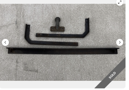
tow bar
by G Walker - 24/08/26 06:52 PM
|
|
|
|
|
Forums39
Topics49,836
Posts837,249
Members9,596
| |
Most Online1,063
Jun 14th, 2026
|
|
|
|
Joined: Jun 2012
Posts: 2,242 Likes: 72
Talk Morgan Expert
|

Talk Morgan Expert
Joined: Jun 2012
Posts: 2,242 Likes: 72 |
If you use a phone sat nav app and like how it works but not that you have to mount your phone on the dash in all the weather, vibrations and on display then consider using a Motorcycle Carplay Screen. It shows the same as what is on your phone, it's waterproof, vibration proof and much cheaper than your phone if someone else like the look of it. Your phone can stay in your pocket and out of sight. They are available for about £50 up and generally work well.
|
|
2 members like this:
CooperMan, PaulV |
|
|
|
|
Joined: Jul 2013
Posts: 3,732 Likes: 79
Talk Morgan Addict
|
|
Talk Morgan Addict
Joined: Jul 2013
Posts: 3,732 Likes: 79 |
It all depends how you plan to use your satnav. If it's to simply navigate between a small number of stops letting the satnav choose the route then phone apps including Google Maps, Waze etc are fine. It's worth downloading offline maps, particularly if you are abroad, to reduce data/roaming charges.
However, when touring we regularly want to pick specific roads/routes, such as a particular alpine pass or fun section of road, and can often want to have have multiple stopping points for example coffee, lunch, viewing points and attractions. The route can be defined by "Shaping" points which direct the route along specific rounds and "Via" points" which are the stop points. Having created the routes (I use MyRouteApp) the resulting gpx files can be shared via email, WhatsApp etc and everyone can load their own satnav unit with the same route.
Both TomTom and Garmin units are fine and for the M3W I'd always recommend a motorcycle unit as it should be waterproof and better able to cope with the vibration.
There are differences in how Garmin and TomTom display the route and in the level of detail available for each planned stop.
Using a Garmin allows you to see the named Shaping and Via points along the route. When you start driving the route the SatNav only shows the named stop points to avoid an over cluttered display, eg Start, Joe's Coffee, XYZ Cafe for lunch, Car museum, Hotel . If you decide to skip a stop it's easy to do on the routing screen and the unit will reroute in accordance with the remaining shaping points.
A TomTom also allows you to load route specific gpx files but doesn't identify the stopping points but simply gives you a list of unnamed points along the route, eg Start, #01, #02, #03, End. This is often fine but you will need to spot your stop locations as you drive by and it's difficult to skip a specific stop along the route.
For me the Garmin is the better option due to the en-route information available.
Red Leader 
|
|
|
|
|
Joined: Jan 2010
Posts: 1,912 Likes: 93
Talk Morgan Enthusiast
|
|
Talk Morgan Enthusiast
Joined: Jan 2010
Posts: 1,912 Likes: 93 |
I’m thinking about trying Calimoto - seems like a useful app which runs on a phone and Car Play.
|
|
|
|
|
Joined: Aug 2014
Posts: 2,116 Likes: 68
Talk Morgan Expert
|
|
Talk Morgan Expert
Joined: Aug 2014
Posts: 2,116 Likes: 68 |
I’m thinking about trying Calimoto - seems like a useful app which runs on a phone and Car Play. I use calimoto on bikes and on my 4/4. I don't miss my Garmin Zumo. I use my older phone on bikes, motorbikes and in my 4/4. One advantage is that my phones are small and I can quick store them in the glove box if we have a break. The option "curvey roots" is not only on my bikes an advantage
Last edited by bmgermany; 06/04/26 09:35 PM.
2005 4/4 1800ccm Duratec and a lot of HONDA CX500.......
|
|
1 member likes this:
Jon G4LJW |
|
|
|
|
Joined: Mar 2014
Posts: 1,737 Likes: 55
Talk Morgan Enthusiast
|
|
Talk Morgan Enthusiast
Joined: Mar 2014
Posts: 1,737 Likes: 55 |
I recently bought a Zumo XT2 satnav and decided to also invest in a Raw-Rides steering column mount. From the moment I unpacked it I could tell it was a quality piece of kit. It’s obvious that a lot of thought and development has gone into its design and it seems to be considerately stronger and stiffer than the original cowl. ![[Linked Image]](https://www.tm-img.com/images/2026/05/03/IMG_0394.jpeg) Fitting couldn’t be easier as it uses the same mounting points as the original cowl. My only tip would be to fix the small screw on the back of the right hand side (behind the key barrel cover) first as I found this to be the most fiddly to get into position. Once this is done, the rest of the screws line up easily. ![[Linked Image]](https://www.tm-img.com/images/2026/05/03/IMG_0399-2.jpeg) It was necessary to remove the front scuttle (under the ‘bonnet’) in order to connect the satnav power cable but this was straightforward. ![[Linked Image]](https://www.tm-img.com/images/2026/05/03/IMG_0402.jpeg) I needn’t have worried that the Zumo XT2 has a slightly larger screen than the XT (for which this product was originally designed) as it still ends up in the perfect position, with the whole screen (save for the very top corners) being clearly visible when driving. Even though the M3W doesn’t offer the smoothest of rides (!) the satnav is held rock-solid. It's reassuring to have the display right in front of you, especially the GPS speedo and current speed limit displays. ![[Linked Image]](https://www.tm-img.com/images/2026/05/03/IMG_0605.jpeg) The first real test for this kit was the Goggles & Gauntlets event on the Isle of Wight and I'm pleased to report that it worked perfectly. All in all, I am delighted with this mount and would thoroughly recommend it. Check it out on the Raw-Rides website HERE. (I have no affiliation with Raw-Rides by the way - other than being a satisfied customer etc. etc.) Note: Even though it's designed to accept the Garmin mount, I did check and it’s just as compatible with my TomTom Rider 500 mount which has the same hardware spacing.
Last edited by Bunny; 03/05/26 04:33 PM.
Andy
|
|
1 member likes this:
CooperMan |
|
|
|
|